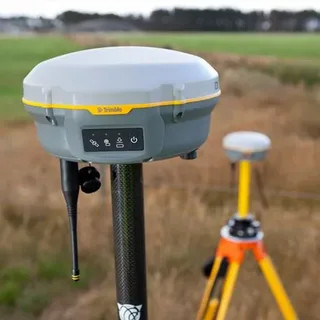
Natural disasters such as earthquakes, floods, hurricanes, and wildfires can strike with little warning, causing massive destruction and endangering lives. In such critical situations, timely information and precise coordination are essential for effective response and recovery. One of the most important technologies supporting these efforts is the Global Navigation Satellite System (GNSS). This article explores the role of gnss in disaster management and rescue, and how it enhances situational awareness, coordination, and efficiency during emergencies.
Understanding GNSS and Its Capabilities
GNSS refers to a constellation of satellites that provide positioning, navigation, and timing (PNT) services globally. The most well-known system is the U.S. GPS, but other systems like Russia’s GLONASS, the EU’s Galileo, and China’s BeiDou also form part of the GNSS family.
These systems are crucial for providing real-time geolocation data with high accuracy. This capability is not only vital for everyday navigation but becomes especially important during disasters when ground infrastructure may be damaged or destroyed.
Real-Time Location Tracking During Emergencies
One of the key advantages of GNSS in disaster scenarios is its ability to provide real-time tracking of people, vehicles, and resources. Rescue teams rely on GNSS devices to navigate through unfamiliar or hazardous environments. Drones equipped with GNSS can also be deployed to assess damage, locate stranded individuals, or deliver emergency supplies to inaccessible areas.
In large-scale disasters, knowing the precise location of emergency responders and affected populations is essential for deploying help where it is needed most. This is a clear demonstration of the role of GNSS in disaster management and rescue.
Enhancing Communication and Coordination
During disasters, traditional communication networks are often disrupted. GNSS can support satellite communication systems that remain operational even when terrestrial systems fail. These systems enable coordination between different agencies, such as fire departments, emergency medical services, and humanitarian organizations.
Additionally, GNSS aids in setting up geofences and safe zones, guiding evacuees and responders with reliable location data. Such coordination significantly reduces confusion and increases the effectiveness of the overall response strategy.
Supporting Post-Disaster Recovery and Analysis
Beyond immediate rescue efforts, GNSS continues to play a vital role in post-disaster recovery. It is used to:
- Map affected areas
- Assess structural damage
- Monitor environmental changes like landslides or aftershocks
- Rebuild infrastructure with precision
These applications further emphasize the role of GNSS in disaster management and rescue, extending its importance beyond the initial emergency phase.
Conclusion
From real-time tracking to coordination and recovery, the role of GNSS in disaster management and rescue is multifaceted and indispensable. As natural and man-made disasters continue to pose threats across the globe, integrating GNSS into emergency response systems will become increasingly vital. By leveraging the full capabilities of GNSS, disaster response teams can save more lives, respond more efficiently, and rebuild more effectively in the aftermath of catastrophe.

